Mill Creek
Introduction
The photograph on this page of Mill Creek by Simon Carey as part of the Geograph project.
The Geograph project started in 2005 with the aim of publishing, organising and preserving representative images for every square kilometre of Great Britain, Ireland and the Isle of Man.

There are currently over 7.5m images from over 14,400 individuals and you can help contribute to the project by visiting https://www.geograph.org.uk
Mill Creek
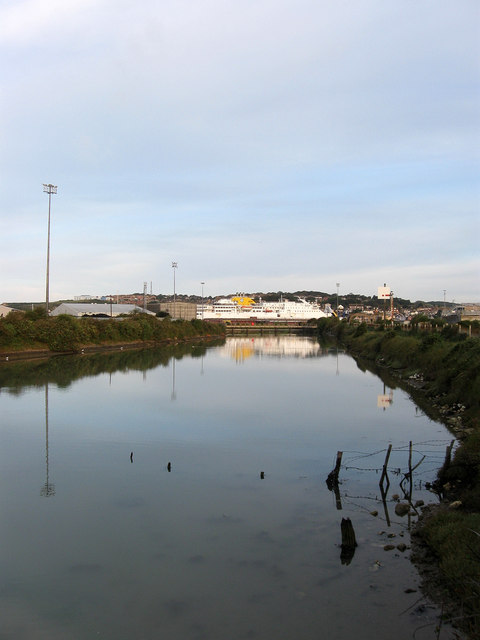
Image: © Simon Carey Taken: 23 Aug 2012
An old course of the River Ouse dating from the 17th century when the shingle bank overran the attempt of cutting a new opening at Newhaven. After the cut was permanently reopened in the 18th century this creek, which was still connected to the river, was used by the founders of Tide Mills both to power their mill and to provide access for their finished product. The creek was closed to traffic in 1879 when the East Quay was improved though it remains tidal. The passenger ferry, Seven Sisters, is currently in port.
Images are licensed for reuse under creativecommons.org/licenses/by-sa/2.0
Image Location
Latitude
50.786761
Longitude
0.060493