Converted farm buildings, by the A338 at Cholderton
Introduction
The photograph on this page of Converted farm buildings, by the A338 at Cholderton by Stefan Czapski as part of the Geograph project.
The Geograph project started in 2005 with the aim of publishing, organising and preserving representative images for every square kilometre of Great Britain, Ireland and the Isle of Man.

There are currently over 7.5m images from over 14,400 individuals and you can help contribute to the project by visiting https://www.geograph.org.uk
Converted farm buildings, by the A338 at Cholderton
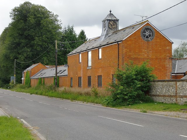
Image: © Stefan Czapski Taken: 21 Aug 2012
I wonder whether this building was once stables. The clock-tower (with pewter cladding?) gives that impression, and so does the blocked upper-storey doorway - which looks as if it once gave on to a hayloft. The clock is dated 1896, on the side facing the road. In 2010 Mike Faherty reported that it wasn't working: http://www.geograph.org.uk/photo/2072226. It so happens that I passed at about 4.45, and the clock is stuck at about ten to five - so I didn't notice.
Images are licensed for reuse under creativecommons.org/licenses/by-sa/2.0
Image Location
Latitude
51.190619
Longitude
-1.670259