South London: The 'Brockley Jack'
Introduction
The photograph on this page of South London: The 'Brockley Jack' by Dr Neil Clifton as part of the Geograph project.
The Geograph project started in 2005 with the aim of publishing, organising and preserving representative images for every square kilometre of Great Britain, Ireland and the Isle of Man.

There are currently over 7.5m images from over 14,400 individuals and you can help contribute to the project by visiting https://www.geograph.org.uk
South London: The 'Brockley Jack'
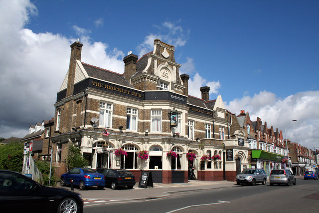
Image: © Dr Neil Clifton Taken: 25 Aug 2012
Large and impressive Victorian public house on the B218. The date stone reads 1898, but it is likely that this is a rebuilding date, for it seems that this pub was at one time the haunt of highwaymen - the sign depicts one such. So it is not unreasonable to suppose that Brockley Jack himself followed this profession.
Images are licensed for reuse under creativecommons.org/licenses/by-sa/2.0
Image Location
Latitude
51.453332
Longitude
-0.038454