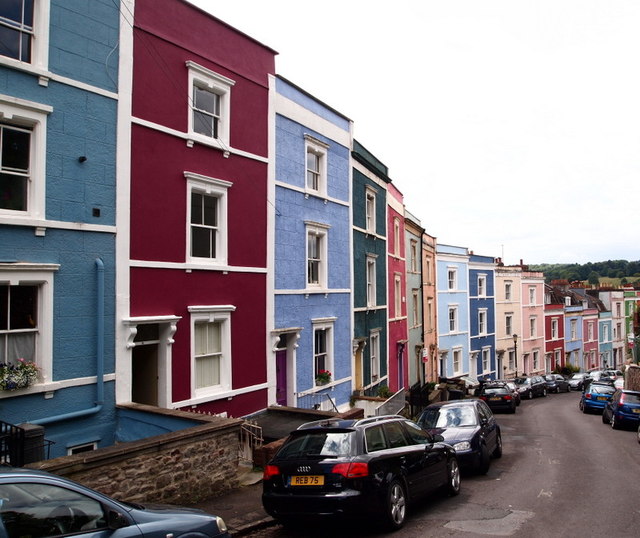
Cliftonwood - BS8
Introduction
The photograph on this page of Cliftonwood - BS8 by David Hallam-Jones as part of the Geograph project.
The Geograph project started in 2005 with the aim of publishing, organising and preserving representative images for every square kilometre of Great Britain, Ireland and the Isle of Man.
There are currently over 7.5m images from over 14,400 individuals and you can help contribute to the project by visiting https://www.geograph.org.uk

Image: © David Hallam-Jones Taken: 1 Aug 2012
The view down Ambrose Road with the junction of Argyle Place behind the photographer.Visitors to any part of the strip of land sandwiched between the southern side of the Floating Harbour and the "New Cut" (i.e. the River Avon) inevitably find their eyes drawn upwards to the very dominant rows of brightly painted houses hugging the lower slopes of Cliftonwood like a multi-coloured knecklace. This picture of the front elevations of those "chocolate box-lid" houses lining Ambrose Road 'proves' that the colours don't simply appear on the rear elevations of each house - to impress tourists visiting the Floating Harbour area - but that the colours can equally surprise and impress observers seeing them from other perspectives too. Whether on dull days or bright sunny days these houses seem to radiate an clearly inferred joie de vivre.

