Cycle network distances from Wyborne Way, London NW10
Introduction
The photograph on this page of Cycle network distances from Wyborne Way, London NW10 by Jaggery as part of the Geograph project.
The Geograph project started in 2005 with the aim of publishing, organising and preserving representative images for every square kilometre of Great Britain, Ireland and the Isle of Man.

There are currently over 7.5m images from over 14,400 individuals and you can help contribute to the project by visiting https://www.geograph.org.uk
Cycle network distances from Wyborne Way, London NW10
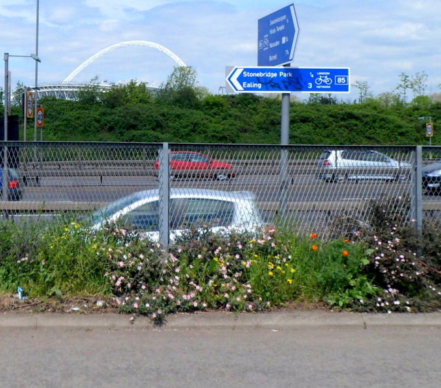
Image: © Jaggery Taken: 13 May 2012
A London Cycle Network signpost on route 85 is located at the northern end of Wyborne Way, alongside the North Circular Road. Distances in miles shown are: Left for Stonebridge Park (¼ ) and Ealing (3). Along Wyborne Way for the Hindu Temple http://www.geograph.org.uk/photo/3096697 (½) Neasden (1½) and Barnet (7½). In the distance is the 134 metre high (440 ft) Wembley Arch. http://www.geograph.org.uk/photo/2406320
Images are licensed for reuse under creativecommons.org/licenses/by-sa/2.0
Image Location
Latitude
51.545726
Longitude
-0.269566