View down the line from Morden South station
Introduction
The photograph on this page of View down the line from Morden South station by Marathon as part of the Geograph project.
The Geograph project started in 2005 with the aim of publishing, organising and preserving representative images for every square kilometre of Great Britain, Ireland and the Isle of Man.

There are currently over 7.5m images from over 14,400 individuals and you can help contribute to the project by visiting https://www.geograph.org.uk
View down the line from Morden South station
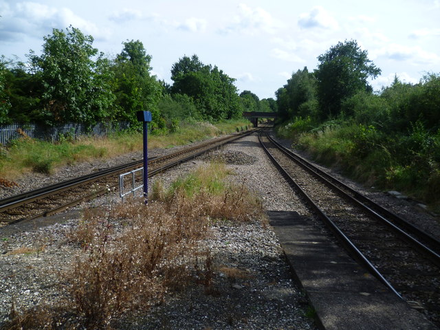
Image: © Marathon Taken: 22 Aug 2012
The Wimbledon to Sutton line was first proposed in the early 1880s with the intention of stimulating house building across the clay pastures between the two towns, which up until then had remained largely untouched. Lack of enthusiasm or downright opposition from established railway companies, particularly the London, Brighton & South Coast Railway, prevented any progress until after the First World War. The LBSCR went to such lengths to prove there was no need for a railway north of Sutton that when a Parliamentary committee in 1910 was considering a Bill for the line they produced a lady who explained that she had once tried to hail a bus which used to run between Wimbledon and Sutton. The conductor was so surprised that he failed to signal to the driver to stop, and the driver turned round to see what the lady was waving at. The line finally opened in 1930, nearly 50 years after it was first proposed. The Wimbledon to Sutton line was designed for electric trains, with many inclines and sharp curves, although it hardly justified the drivers' nickname for it: "Wall of Death". Morden South, along with other stations on the line, has a single central platform. It is the most memorable station on the line because of the huge Ahmadiyya Mosque of the Ahmadiyya Muslim Community UK next to it. This is the view from the end of the platform in the other direction towards Central Road bridge.
Images are licensed for reuse under creativecommons.org/licenses/by-sa/2.0
Image Location
Latitude
51.393765
Longitude
-0.198691