Redundant filling station
Introduction
The photograph on this page of Redundant filling station by Jonathan Billinger as part of the Geograph project.
The Geograph project started in 2005 with the aim of publishing, organising and preserving representative images for every square kilometre of Great Britain, Ireland and the Isle of Man.

There are currently over 7.5m images from over 14,400 individuals and you can help contribute to the project by visiting https://www.geograph.org.uk
Redundant filling station
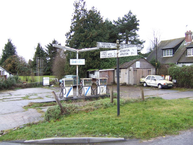
Image: © Jonathan Billinger Taken: 10 Jan 2007
This used to be on the A420 passing through the village until a bypass was built years ago. The sign in the foreground shows the direction from left to right of the old main road.
Images are licensed for reuse under creativecommons.org/licenses/by-sa/2.0
Image Location


Leaflet Map data © OpenStreetMap
Latitude
51.685568
Longitude
-1.390685