Sowton
Introduction
The photograph on this page of Sowton by Derek Harper as part of the Geograph project.
The Geograph project started in 2005 with the aim of publishing, organising and preserving representative images for every square kilometre of Great Britain, Ireland and the Isle of Man.

There are currently over 7.5m images from over 14,400 individuals and you can help contribute to the project by visiting https://www.geograph.org.uk
Sowton
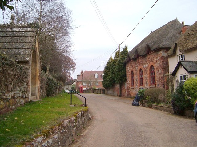
Image: © Derek Harper Taken: 14 Mar 2006
The Village Hall on the right, also shown in http://www.geograph.org.uk/search.php?i=35201499 , was " formerly a school, originally possibly a barn attached to the adjacent range of cottages" (right) http://list.english-heritage.org.uk/resultsingle.aspx?uid=1334002&searchtype=mapsearch . "Included for group value; it occupies an important site opposite the parish church." The cottages to its right are also listed http://list.english-heritage.org.uk/resultsingle.aspx?uid=1164941&searchtype=mapsearch , as is the lych gate (left) http://list.english-heritage.org.uk/resultsingle.aspx?uid=1164889&searchtype=mapsearch . Further listed buildings illustrated are the telephone box http://list.english-heritage.org.uk/resultsingle.aspx?uid=1393239&searchtype=mapsearch , which "has a strong visual relationship with five listed buildings", and the former farmhouse behind it http://list.english-heritage.org.uk/resultsingle.aspx?uid=1317609&searchtype=mapsearch .
Images are licensed for reuse under creativecommons.org/licenses/by-sa/2.0
Image Location
Latitude
50.723073
Longitude
-3.451914