Former railway bridges
Introduction
The photograph on this page of Former railway bridges by Sandy Gemmill as part of the Geograph project.
The Geograph project started in 2005 with the aim of publishing, organising and preserving representative images for every square kilometre of Great Britain, Ireland and the Isle of Man.

There are currently over 7.5m images from over 14,400 individuals and you can help contribute to the project by visiting https://www.geograph.org.uk
Former railway bridges
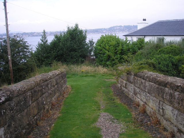
Image: © Sandy Gemmill Taken: 14 Aug 2012
The view of two walls as seen from Commonty Road/Dalgleish Street of two walls which appear to block the route of the former railway line from Newport-on-Tay. However the actual railway line was about twenty feet below these walls since the cutting has been filled in Image and all that is still visible are the tops of the bridges.
Images are licensed for reuse under creativecommons.org/licenses/by-sa/2.0
Image Location
Latitude
56.450898
Longitude
-2.885758