Site of Cold Norton station
Introduction
The photograph on this page of Site of Cold Norton station by Ben Brooksbank as part of the Geograph project.
The Geograph project started in 2005 with the aim of publishing, organising and preserving representative images for every square kilometre of Great Britain, Ireland and the Isle of Man.

There are currently over 7.5m images from over 14,400 individuals and you can help contribute to the project by visiting https://www.geograph.org.uk
Site of Cold Norton station
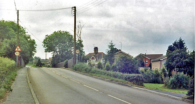
Image: © Ben Brooksbank Taken: 24 Jun 1984
View westward on B1012 to the bridge over the track of the Woodham Ferrers (left) - Maldon West) (right) ex-GE branch. The station had been on the right, but was closed when the passenger service ceased on 10/9/39, although the line remained open for goods until 1/4/53. (See also Roger Jones' image Image, looking the other way.)
Images are licensed for reuse under creativecommons.org/licenses/by-sa/2.0
Image Location
Latitude
51.671662
Longitude
0.672868