Wollaton: cottages on the corner of Bramcote Lane
Introduction
The photograph on this page of Wollaton: cottages on the corner of Bramcote Lane by John Sutton as part of the Geograph project.
The Geograph project started in 2005 with the aim of publishing, organising and preserving representative images for every square kilometre of Great Britain, Ireland and the Isle of Man.

There are currently over 7.5m images from over 14,400 individuals and you can help contribute to the project by visiting https://www.geograph.org.uk
Wollaton: cottages on the corner of Bramcote Lane
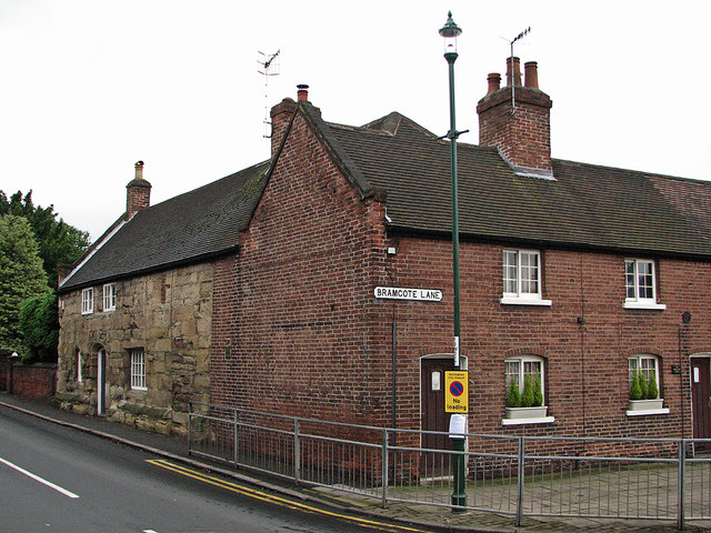
Image: © John Sutton Taken: 20 Jul 2012
The stone house opposite the church dates from around 1500, the brick cottages in Wollaton Square from the 18th century. See http://www.britishlistedbuildings.co.uk/en-459112-the-chantry-737-nottingham and http://www.britishlistedbuildings.co.uk/en-458901-2-2a-and-4-nottingham for their British Listed Buildings citations, and Alan Murray-Rust's Image] for some of the context. The mediaeval house is shown in more detail in my Image] and Image
Images are licensed for reuse under creativecommons.org/licenses/by-sa/2.0
Image Location


Leaflet Map data © OpenStreetMap
Latitude
52.953023
Longitude
-1.220911