Ups and Downs
Introduction
The photograph on this page of Ups and Downs by David M Lear as part of the Geograph project.
The Geograph project started in 2005 with the aim of publishing, organising and preserving representative images for every square kilometre of Great Britain, Ireland and the Isle of Man.

There are currently over 7.5m images from over 14,400 individuals and you can help contribute to the project by visiting https://www.geograph.org.uk
Ups and Downs
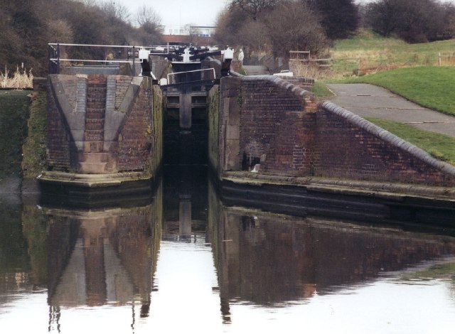
Image: © David M Lear Taken: 8 Mar 2005
"Delph Locks" connects the Dudley #1 Canal to the Stourbridge Canal. Built in 1858 to replace the "original" locks built in 1779. These suffered mining subsidence, common in the "blackcountry". The original route is to the right of the picture.
Images are licensed for reuse under creativecommons.org/licenses/by-sa/2.0
Image Location


Leaflet Map data © OpenStreetMap
Latitude
52.476366
Longitude
-2.122156