Acairseid Mh?r, Eiriosgaigh (Eriskay)
Introduction
The photograph on this page of Acairseid Mh?r, Eiriosgaigh (Eriskay) by Tom Pullman as part of the Geograph project.
The Geograph project started in 2005 with the aim of publishing, organising and preserving representative images for every square kilometre of Great Britain, Ireland and the Isle of Man.

There are currently over 7.5m images from over 14,400 individuals and you can help contribute to the project by visiting https://www.geograph.org.uk
Acairseid Mh?r, Eiriosgaigh (Eriskay)
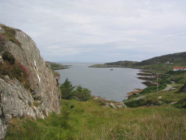
Image: © Tom Pullman Taken: 7 Aug 2004
Looking ESE down the inlet of Acairseid Mhòr ("large anchorage") on the east side of Eriskay. A tarmac road is visible, which must be quite recent as the OS map shows only a path.
Images are licensed for reuse under creativecommons.org/licenses/by-sa/2.0
Image Location


Leaflet Map data © OpenStreetMap
Latitude
57.066754
Longitude
-7.300826