Church of St. Hibald, Hibaldstow
Introduction
The photograph on this page of Church of St. Hibald, Hibaldstow by David Wright as part of the Geograph project.
The Geograph project started in 2005 with the aim of publishing, organising and preserving representative images for every square kilometre of Great Britain, Ireland and the Isle of Man.

There are currently over 7.5m images from over 14,400 individuals and you can help contribute to the project by visiting https://www.geograph.org.uk
Church of St. Hibald, Hibaldstow
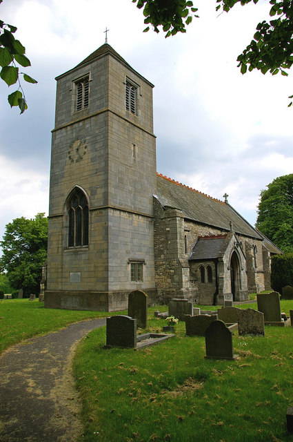
Image: © David Wright Taken: 7 Jun 2006
Church of St. Hibald. The church tower fell down during rebuilding in 1875 and was not replaced until 1958 (hence marked as church without spire or tower on 1940's OS map). The new tower is of concrete blocks to look like ashlar and the effect is, to my eye, rather industrial.
Images are licensed for reuse under creativecommons.org/licenses/by-sa/2.0
Image Location
Latitude
53.510965
Longitude
-0.524131