Gilnow Mill - 2
Introduction
The photograph on this page of Gilnow Mill - 2 by Alan Murray-Rust as part of the Geograph project.
The Geograph project started in 2005 with the aim of publishing, organising and preserving representative images for every square kilometre of Great Britain, Ireland and the Isle of Man.

There are currently over 7.5m images from over 14,400 individuals and you can help contribute to the project by visiting https://www.geograph.org.uk
Gilnow Mill - 2
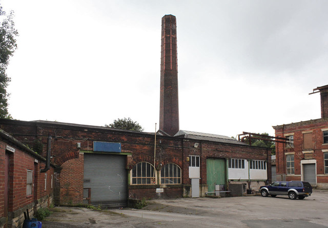
Image: © Alan Murray-Rust Taken: 25 Jul 2012
This has been substantially modified over the years. Once the main steam engine ceased to be used, the boiler capacity would have been reduced to what was necessary to provide heating throughout the mill, and other use made of parts of the building. The boilers would probably have been in the left hand part of the building with the round-topped windows; the right hand side with the white panels was the coal bunker area.
Images are licensed for reuse under creativecommons.org/licenses/by-sa/2.0
Image Location
Latitude
53.575677
Longitude
-2.448342