Spencer's Bridge near Moira
Introduction
The photograph on this page of Spencer's Bridge near Moira by Albert Bridge as part of the Geograph project.
The Geograph project started in 2005 with the aim of publishing, organising and preserving representative images for every square kilometre of Great Britain, Ireland and the Isle of Man.

There are currently over 7.5m images from over 14,400 individuals and you can help contribute to the project by visiting https://www.geograph.org.uk
Spencer's Bridge near Moira
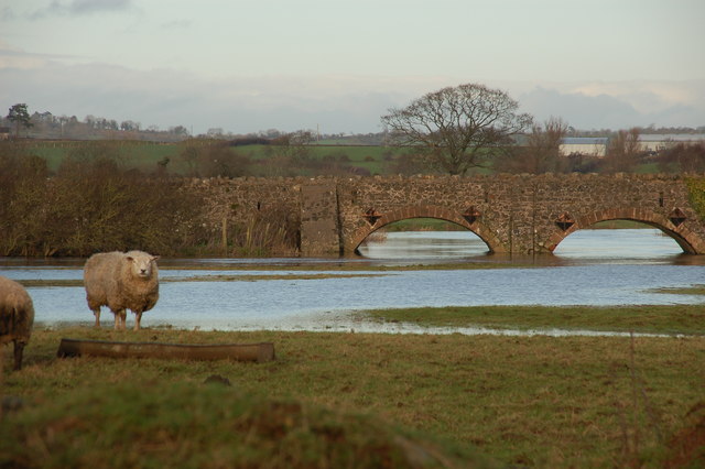
Image: © Albert Bridge Taken: 9 Jan 2007
Spencer’s (also “Spence’s”) Bridge carries an unclassified road across the Lagan between Flatfield and Broomhedge. It is described in “The Industrial Archaeology of Northern Ireland” as “noteworthy” but the date of construction is not given. The river is in flood after some heavy rain. See also Image The view is downstream towards Lisburn and Belfast.
Images are licensed for reuse under creativecommons.org/licenses/by-sa/2.0
Image Location
Latitude
54.479125
Longitude
-6.172585