Fulking
Introduction
The photograph on this page of Fulking by Val Vannet as part of the Geograph project.
The Geograph project started in 2005 with the aim of publishing, organising and preserving representative images for every square kilometre of Great Britain, Ireland and the Isle of Man.

There are currently over 7.5m images from over 14,400 individuals and you can help contribute to the project by visiting https://www.geograph.org.uk
Fulking
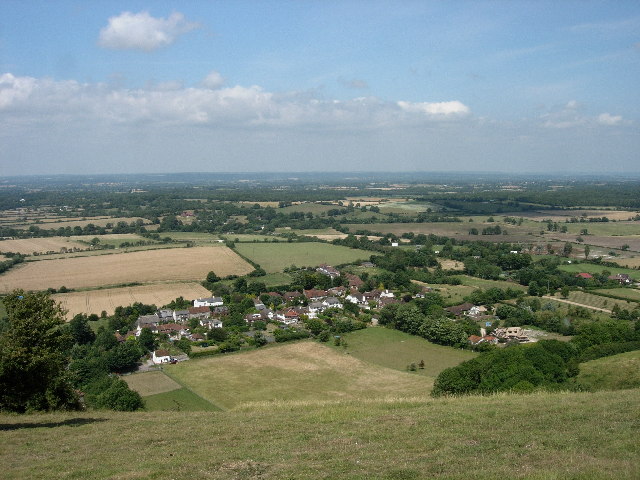
Image: © Val Vannet Taken: 18 Jul 2005
The village of Fulking is a classic spring line settlement. It is viewed here from the South Downs Way which runs along the top of the South Downs escarpment.
Images are licensed for reuse under creativecommons.org/licenses/by-sa/2.0
Image Location
Latitude
50.889578
Longitude
-0.23129