Ordnance Survey bolt at Deal Castle
Introduction
The photograph on this page of Ordnance Survey bolt at Deal Castle by Shantavira as part of the Geograph project.
The Geograph project started in 2005 with the aim of publishing, organising and preserving representative images for every square kilometre of Great Britain, Ireland and the Isle of Man.

There are currently over 7.5m images from over 14,400 individuals and you can help contribute to the project by visiting https://www.geograph.org.uk
Ordnance Survey bolt at Deal Castle
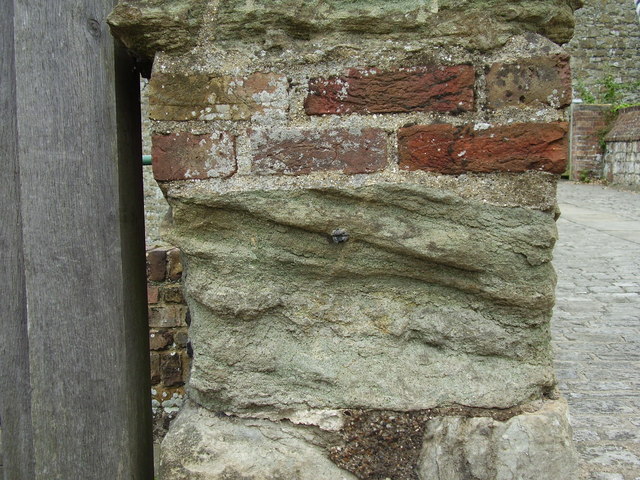
Image: © Shantavira Taken: 8 Aug 2012
Ordnance Survey bolt benchmark on the west face of the northern gatepost at the entrance to Deal Castle. This bench mark was established in 1851 during the First primary levelling of England & Wales, and was levelled with a height of 20.9340 feet [6.3807 metres] above mean sea level (Liverpool datum). It was included on the London to Dover levelling line. The surveyor's description was "No. 368. Bolt in corner of wall at entrance to Deal Castle ; 2.17 ft. above surface (p197)." The chiselled OS broad arrow has completely eroded away, but the bolt with its horizontal datum line (centre of photo) has survived.
Images are licensed for reuse under creativecommons.org/licenses/by-sa/2.0
Image Location
Latitude
51.219473
Longitude
1.402824