Road to Little Heath military site, Barnham
Introduction
The photograph on this page of Road to Little Heath military site, Barnham by John Goldsmith as part of the Geograph project.
The Geograph project started in 2005 with the aim of publishing, organising and preserving representative images for every square kilometre of Great Britain, Ireland and the Isle of Man.

There are currently over 7.5m images from over 14,400 individuals and you can help contribute to the project by visiting https://www.geograph.org.uk
Road to Little Heath military site, Barnham
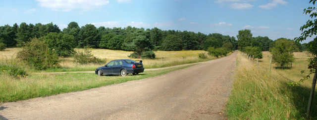
Image: © John Goldsmith Taken: 11 Aug 2012
This is officially Station Road, although the station was far away at the northern end of it. It leads to the Little Heath military site, used for tank testing in WW1, chemical weapon storage in WW2 and after, then (illegal) storage of old tyres, then a tank museum, and now a company making wooden shavings for horse bedding. This photo was taken from the gate to the site, although the fence on the right encloses a larger ex-military area on that side, full of mysterious earthworks. On the left a dirt track turns off to curve round the western side of the site. My MG ZS180 makes another Geograph appearance. The field on the left is designated as Open Access but the vegetation growth doesn't make access easy, suggesting it is not actually used.
Images are licensed for reuse under creativecommons.org/licenses/by-sa/2.0
Image Location
Latitude
52.37003
Longitude
0.721458