Brook and Bridge Mills
Introduction
The photograph on this page of Brook and Bridge Mills by Alan Murray-Rust as part of the Geograph project.
The Geograph project started in 2005 with the aim of publishing, organising and preserving representative images for every square kilometre of Great Britain, Ireland and the Isle of Man.

There are currently over 7.5m images from over 14,400 individuals and you can help contribute to the project by visiting https://www.geograph.org.uk
Brook and Bridge Mills
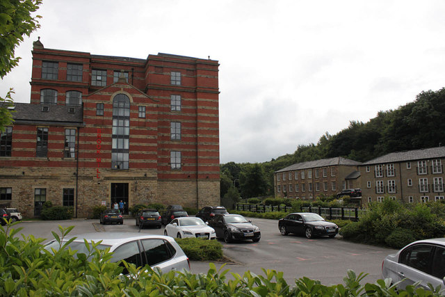
Image: © Alan Murray-Rust Taken: 25 Jul 2012
When the site was at its height, there was another mill to the right of Brook Mill (left) which would have completely obscured Bridge Mill in the background; the modern car park site was also completely built over.
Images are licensed for reuse under creativecommons.org/licenses/by-sa/2.0
Image Location
Latitude
53.613955
Longitude
-2.427283