All Saints Church, West Stourmouth
Introduction
The photograph on this page of All Saints Church, West Stourmouth by Bill Boaden as part of the Geograph project.
The Geograph project started in 2005 with the aim of publishing, organising and preserving representative images for every square kilometre of Great Britain, Ireland and the Isle of Man.

There are currently over 7.5m images from over 14,400 individuals and you can help contribute to the project by visiting https://www.geograph.org.uk
All Saints Church, West Stourmouth
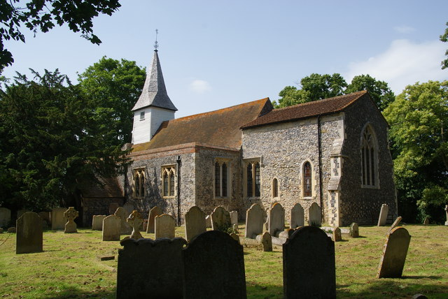
Image: © Bill Boaden Taken: 28 Jun 2012
No longer in use for services, but a Grade I listed building with Saxon origins.
Images are licensed for reuse under creativecommons.org/licenses/by-sa/2.0
Image Location
Latitude
51.320173
Longitude
1.236438