Elm Lane
Introduction
The photograph on this page of Elm Lane by John Baker as part of the Geograph project.
The Geograph project started in 2005 with the aim of publishing, organising and preserving representative images for every square kilometre of Great Britain, Ireland and the Isle of Man.

There are currently over 7.5m images from over 14,400 individuals and you can help contribute to the project by visiting https://www.geograph.org.uk
Elm Lane
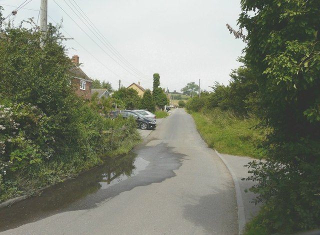
Image: © John Baker Taken: 26 Jul 2012
Although it is a very narrow lane, it forms a rat-run between Chequers Road and Scocles Road and therefore sees a fair number of vehicles. This is the point that The Sheppey Light Railway crossed the lane. According to http://www.sheppeywebsite.co.uk/index.php?id=95 it opened on 1 August 1901 and closed on 4 December 1950. The total length was 8 miles 52 chains. It ran from Queenborough (where there was a north-facing bay platform on the east side of the station) to Leysdown with intermediate stations at Sheerness East, East Minster-on-Sea (which was actually west of Minster), Minster-on-Sea (they're only given as Minster in the link), Brambledown Halt, Eastchurch and Harty Road Halt. Today, one can trace most of the route from the air and on the Ordnance Survey map (Explorer 149). On the ground, one can find sections overgrown with grass, brambles and trees (as here to the left), sections built over, sections concreted over to form a permanent way (as here to the right, which leads to Sheppey Light Farm) or landscaped to form paths for pedestrians.
Images are licensed for reuse under creativecommons.org/licenses/by-sa/2.0
Image Location
Latitude
51.415244
Longitude
0.819114