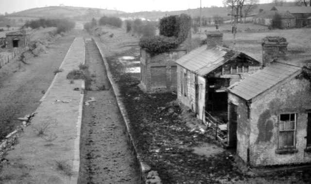
Former Ballynahinch Junction station (1983-1)
Introduction
The photograph on this page of Former Ballynahinch Junction station (1983-1) by Albert Bridge as part of the Geograph project.
The Geograph project started in 2005 with the aim of publishing, organising and preserving representative images for every square kilometre of Great Britain, Ireland and the Isle of Man.
There are currently over 7.5m images from over 14,400 individuals and you can help contribute to the project by visiting https://www.geograph.org.uk

Image: © Albert Bridge Taken: 13 Feb 1983
See Image (March 1980). Three years later and the station's building had deteriorated to the extent that part of the former passenger station no longer existed. The view is towards Comber and Belfast. When open the station had this island platform connected to the down platform (right) by a footbridge upon which the down starting signals were mounted. Trains for the Ballynahinch branch used the face on the left. The remains of the water tower are at top left. The station buildings are on the right and, behind them, the base of the signal cabin. The station existed as a junction. Local passenger traffic was minimal. Image (November 2008) shows the post-demolition view. Image shows the view from the other side of the bridge.

