NATO "Ace High" station, Coldblow Lane, Friningham
Introduction
The photograph on this page of NATO "Ace High" station, Coldblow Lane, Friningham by Peter Facey as part of the Geograph project.
The Geograph project started in 2005 with the aim of publishing, organising and preserving representative images for every square kilometre of Great Britain, Ireland and the Isle of Man.

There are currently over 7.5m images from over 14,400 individuals and you can help contribute to the project by visiting https://www.geograph.org.uk
NATO "Ace High" station, Coldblow Lane, Friningham
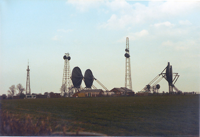
Image: © Peter Facey Taken: 15 May 1983
In May 1983. For information on this defunct military communications network, see http://www.subbrit.org.uk/rsg/features/ace_high/index4.html The large dishes communicated with the continent by tropospheric scatter. The mast-mounted small dishes are SHF and communicated with Dunkirk (which is west of Canterbury). For the site in 2005, see Image
Images are licensed for reuse under creativecommons.org/licenses/by-sa/2.0
Image Location
Latitude
51.295541
Longitude
0.613372