Strolling home: the South Circular Road on the morning of the first Olympic road race
Introduction
The photograph on this page of Strolling home: the South Circular Road on the morning of the first Olympic road race by Stefan Czapski as part of the Geograph project.
The Geograph project started in 2005 with the aim of publishing, organising and preserving representative images for every square kilometre of Great Britain, Ireland and the Isle of Man.

There are currently over 7.5m images from over 14,400 individuals and you can help contribute to the project by visiting https://www.geograph.org.uk
Strolling home: the South Circular Road on the morning of the first Olympic road race
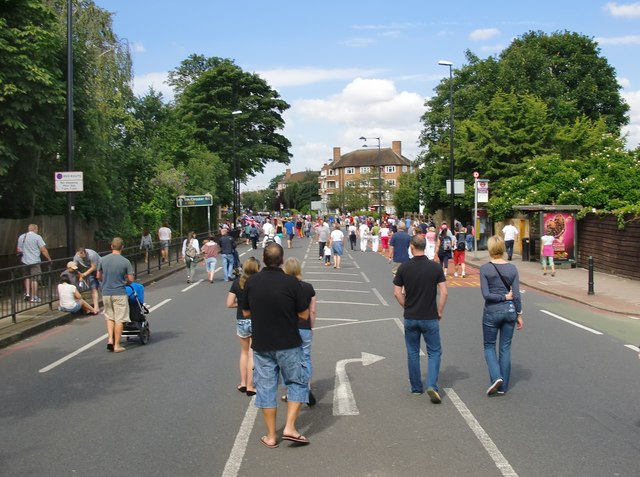
Image: © Stefan Czapski Taken: 28 Jul 2012
A shot taken a few minutes after the men's road race had passed through on its way to the Boxhill circuit. This stretch of Upper Richmond Road (between Priory Lane/Vine Road and Priest's Bridge) was not part of the Olympic course, but was included in the closures which lasted for much of the weekend. The timing of the event - on the morning after the opening ceremony - along with the fine weather, brought local people out in their thousands. Here we are, heading home, and making the most of a rare opportunity to amble right down the middle of the South Circular. The race came back some five hours later, drawing - if anything - even larger crowds.
Images are licensed for reuse under creativecommons.org/licenses/by-sa/2.0
Image Location
Latitude
51.465168
Longitude
-0.252316