Merthyr Cynog
Introduction
The photograph on this page of Merthyr Cynog by Alan Richards as part of the Geograph project.
The Geograph project started in 2005 with the aim of publishing, organising and preserving representative images for every square kilometre of Great Britain, Ireland and the Isle of Man.

There are currently over 7.5m images from over 14,400 individuals and you can help contribute to the project by visiting https://www.geograph.org.uk
Merthyr Cynog
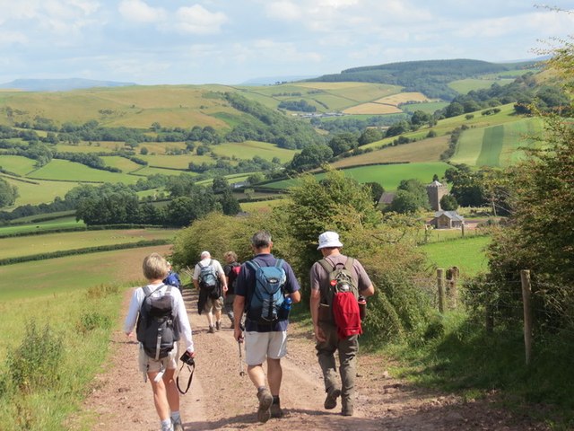
Image: © Alan Richards Taken: 29 Jul 2012
Cerddwyr yn anelu i lawr o'r ucheldir tuag at bentre bach Merthyr Cynog. Y cwm yn y pellter yw Ysgir Fawr. Walkers descending towards the tiny village of Merthyr Cynog. The valley in the distance is that of Cwm Ysgir Fawr.
Images are licensed for reuse under creativecommons.org/licenses/by-sa/2.0
Image Location
Latitude
52.026141
Longitude
-3.481209