The former White Lion pub - building development
Introduction
The photograph on this page of The former White Lion pub - building development by John Webb as part of the Geograph project.
The Geograph project started in 2005 with the aim of publishing, organising and preserving representative images for every square kilometre of Great Britain, Ireland and the Isle of Man.

There are currently over 7.5m images from over 14,400 individuals and you can help contribute to the project by visiting https://www.geograph.org.uk
The former White Lion pub - building development
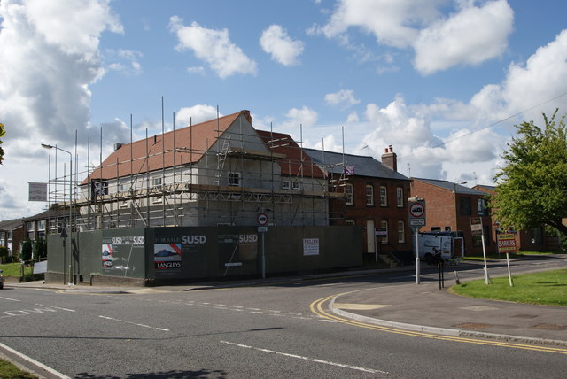
Image: © John Webb Taken: 30 Jul 2012
The former White Lion pub on the 30th July 2012 with new extension nearest the camera almost complete (based on a 1930s drawing of a building once forming part of the pub) as the site is redeveloped as housing. Compare with Image for a view in September 2011 at an early stage in the redevelopment of this site and with Image for a view prior to closure. Note that the developers have retained the pub sign which can be seen amidst the scaffolding! (The large extension was passed by the planners despite complaints from locals that it would make exiting from St Anne's Road alongside the pub more hazardous!)
Images are licensed for reuse under creativecommons.org/licenses/by-sa/2.0
Image Location
Latitude
51.720785
Longitude
-0.29286