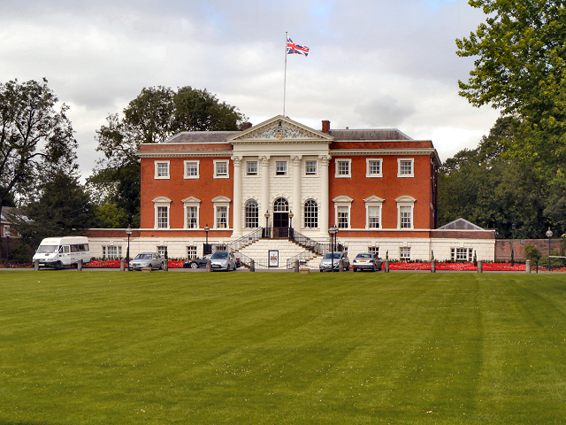
Warrington Town Hall (Bank Hall)
Introduction
The photograph on this page of Warrington Town Hall (Bank Hall) by David Dixon as part of the Geograph project.
The Geograph project started in 2005 with the aim of publishing, organising and preserving representative images for every square kilometre of Great Britain, Ireland and the Isle of Man.
There are currently over 7.5m images from over 14,400 individuals and you can help contribute to the project by visiting https://www.geograph.org.uk

Image: © David Dixon Taken: 27 Jul 2012
Bank Hall was built in 1750. At the time, it was set in open fields which extended down to the River Mersey. Later, a perimeter wall was added around the grounds to provide some privacy as the population of Warrington began to grow. The town council bought the hall, along with the 13-acre grounds surrounding it, in 1872. The building has been the Town Hall ever since, and the grounds are known as Bank Park, which were opened as the town's first public park in 1873. The building is Grade I listed (http://list.english-heritage.org.uk/resultsingle.aspx?uid=1329725 The National Heritage List for England).

