Avery House
Introduction
The photograph on this page of Avery House by Stephen Craven as part of the Geograph project.
The Geograph project started in 2005 with the aim of publishing, organising and preserving representative images for every square kilometre of Great Britain, Ireland and the Isle of Man.

There are currently over 7.5m images from over 14,400 individuals and you can help contribute to the project by visiting https://www.geograph.org.uk
Avery House
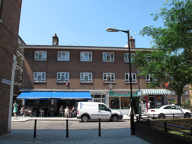
Image: © Stephen Craven Taken: 26 Jul 2012
Avery House is a three-sided block of social housing; this is the east wing on Redcross Way, facing Disney Street. On the ground floor are a cafe, cobblers and convenience store.
Images are licensed for reuse under creativecommons.org/licenses/by-sa/2.0
Image Location
Latitude
51.502644
Longitude
-0.094981