Former Methodist Chapel
Introduction
The photograph on this page of Former Methodist Chapel by Richard Croft as part of the Geograph project.
The Geograph project started in 2005 with the aim of publishing, organising and preserving representative images for every square kilometre of Great Britain, Ireland and the Isle of Man.

There are currently over 7.5m images from over 14,400 individuals and you can help contribute to the project by visiting https://www.geograph.org.uk
Former Methodist Chapel
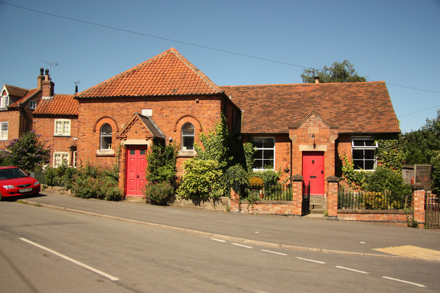
Image: © Richard Croft Taken: 24 Jul 2012
Built on land donated by Rev.W.Sturtevant in 1827, the datestone of 1843 records its re-opening as a Wesleyan Chapel. Enlarged in 1909 with a schoolroom, it became a private residence in 1991.
Images are licensed for reuse under creativecommons.org/licenses/by-sa/2.0
Image Location
Latitude
53.147837
Longitude
-0.84613