South Hatfield: The Church of St John (2)
Introduction
The photograph on this page of South Hatfield: The Church of St John (2) by Nigel Cox as part of the Geograph project.
The Geograph project started in 2005 with the aim of publishing, organising and preserving representative images for every square kilometre of Great Britain, Ireland and the Isle of Man.

There are currently over 7.5m images from over 14,400 individuals and you can help contribute to the project by visiting https://www.geograph.org.uk
South Hatfield: The Church of St John (2)
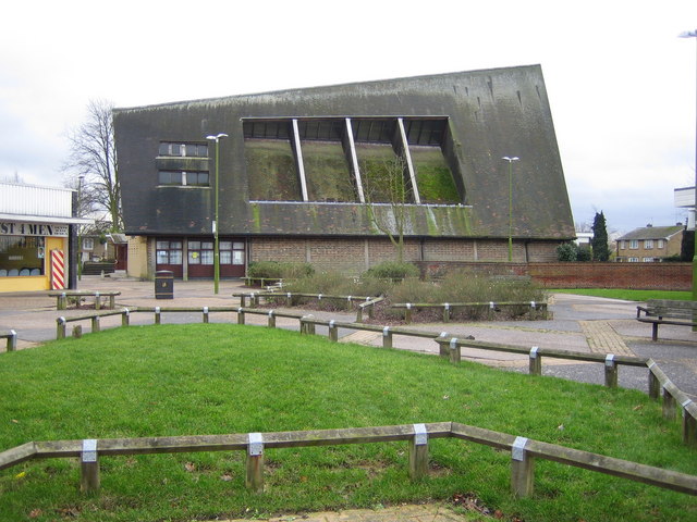
Image: © Nigel Cox Taken: 5 Jan 2007
This is the northern façade of the church showing the varying height of the ridge of the roof, and the inset roof panels with glass at their tops. The Church was built in 1958 and the inset roof now has a substantial build-up of moss. The western façade of the Church (the right hand end in this image) is shown here Image
Images are licensed for reuse under creativecommons.org/licenses/by-sa/2.0
Image Location


Leaflet Map data © OpenStreetMap
Latitude
51.747545
Longitude
-0.235644