Upper Norwood: Looking down Gipsy Hill
Introduction
The photograph on this page of Upper Norwood: Looking down Gipsy Hill by Dr Neil Clifton as part of the Geograph project.
The Geograph project started in 2005 with the aim of publishing, organising and preserving representative images for every square kilometre of Great Britain, Ireland and the Isle of Man.

There are currently over 7.5m images from over 14,400 individuals and you can help contribute to the project by visiting https://www.geograph.org.uk
Upper Norwood: Looking down Gipsy Hill
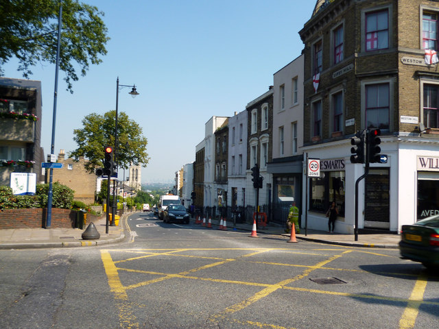
Image: © Dr Neil Clifton Taken: 26 Jul 2012
At this important and often congested South London junction, all the roads change name. Straight ahead is Gipsy Hill, with the tower of All Saints Church prominent in the middle distance; to the left is Central Hill, linking to West Norwood and Streatham; to the right is Westow Hill, leading to Crystal Palace Park; and behind the photographer is Westow Street, coming up from the Croydon direction. Central Hill and Westow Hill are both part of the A214, but the other roads are not classified. Motorists not familiar with this area are advised to avoid it altogether, if possible.
Images are licensed for reuse under creativecommons.org/licenses/by-sa/2.0
Image Location
Latitude
51.420261
Longitude
-0.083306