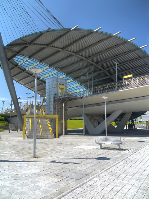
Central Park Metrolink Station
Introduction
The photograph on this page of Central Park Metrolink Station by David Dixon as part of the Geograph project.
The Geograph project started in 2005 with the aim of publishing, organising and preserving representative images for every square kilometre of Great Britain, Ireland and the Isle of Man.
There are currently over 7.5m images from over 14,400 individuals and you can help contribute to the project by visiting https://www.geograph.org.uk

Image: © David Dixon Taken: 22 Jul 2012
Central Park Station, part of the recently (June 2012) opened Metrolink “phase 3A” expansion to Oldham, is certainly the most impressive tram stop on the network to date, featuring a striking curved copper and glass canopy suspended by a cable-tensioned steel structure. The station serves The Central Park Urban Regeneration Area in north-east Manchester. It forms part of The Gateway, a £36.5 million transport interchange which will include local bus services as well as the Metrolink tram stop (http://www.manchester.gov.uk/site/scripts/news_article.php?newsID=1582 Manchester City Council). http://www.metrolink.co.uk/stationinfo/results/index.asp Metrolink http://en.wikipedia.org/wiki/Central_Park_Metrolink_station Wikipedia

