Legoniel and Wolf Hill, Belfast
Introduction
The photograph on this page of Legoniel and Wolf Hill, Belfast by Albert Bridge as part of the Geograph project.
The Geograph project started in 2005 with the aim of publishing, organising and preserving representative images for every square kilometre of Great Britain, Ireland and the Isle of Man.

There are currently over 7.5m images from over 14,400 individuals and you can help contribute to the project by visiting https://www.geograph.org.uk
Legoniel and Wolf Hill, Belfast
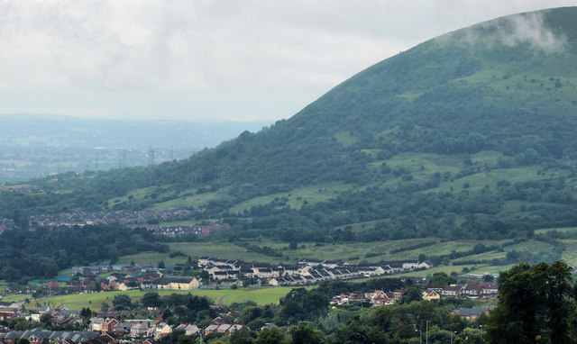
Image: © Albert Bridge Taken: 24 Jul 2012
Once a mill village and now part of north Belfast, Legoniel has spread uphill towards the Horseshoe Image Wolf Hill takes up most of the view. The road and bus destinations use the spelling “Ligoniel”. OSNI uses the traditional “Legoniel” for the area.
Images are licensed for reuse under creativecommons.org/licenses/by-sa/2.0
Image Location
Latitude
54.628475
Longitude
-5.992604