The Chambers
Introduction
The photograph on this page of The Chambers by David Dixon as part of the Geograph project.
The Geograph project started in 2005 with the aim of publishing, organising and preserving representative images for every square kilometre of Great Britain, Ireland and the Isle of Man.

There are currently over 7.5m images from over 14,400 individuals and you can help contribute to the project by visiting https://www.geograph.org.uk
The Chambers
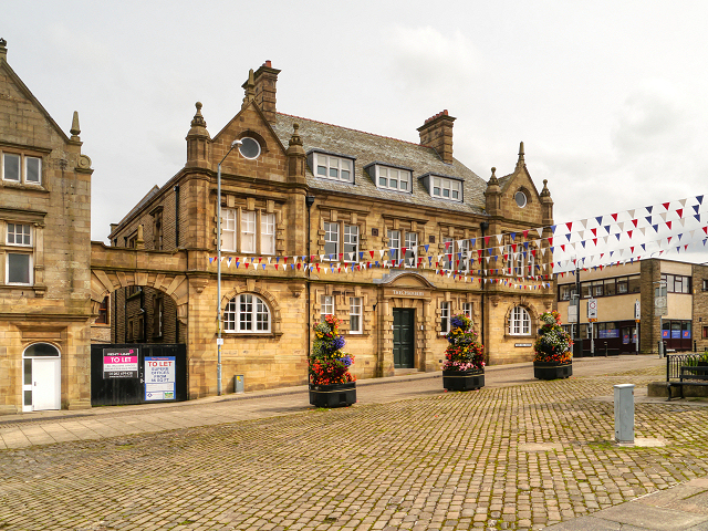
Image: © David Dixon Taken: 21 Jul 2012
Great Harwood’s Town Hall was completed in 1900; it was built on the site of a row of ancient cottages. The listed building was re-opened in 2011 as a new business and enterprise centre, known as “the Chambers”. It is a Grade II listed building (http://www.britishlistedbuildings.co.uk/en-183882-town-hall-great-harwood British Listed Buildings).
Images are licensed for reuse under creativecommons.org/licenses/by-sa/2.0
Image Location
Latitude
53.785696
Longitude
-2.407931