
High Ridgeway Bridge
Introduction
The photograph on this page of High Ridgeway Bridge by Rob Farrow as part of the Geograph project.
The Geograph project started in 2005 with the aim of publishing, organising and preserving representative images for every square kilometre of Great Britain, Ireland and the Isle of Man.

There are currently over 7.5m images from over 14,400 individuals and you can help contribute to the project by visiting https://www.geograph.org.uk
High Ridgeway Bridge
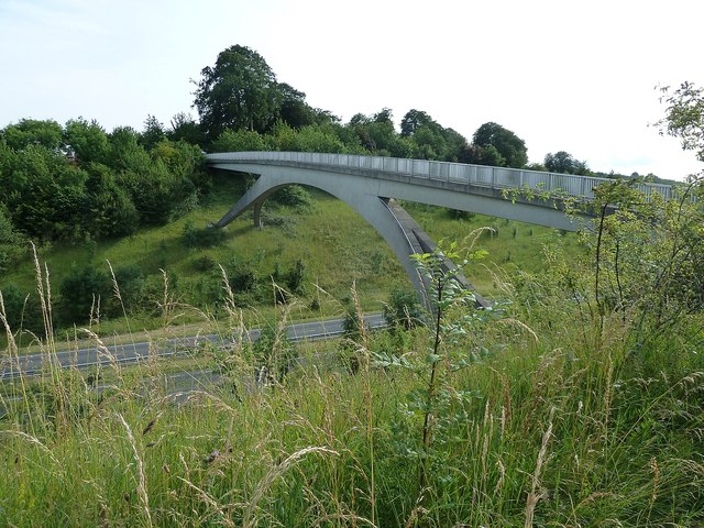
Image: © Rob Farrow Taken: 21 Jul 2012
This graceful, tall bridge to the east of Tring carries the Ridgeway LDP (Long Distance Path) across the busy A41 Dual Carriageway. Several other less important footpaths were severed by the construction of this road and for most of them the walker has to brave crossing four lanes of 70mph traffic - not for the faint-hearted. But the Ridgeway was too important an ancient track to suffer this fate, so this elegant bridge was created. It is particularly noticeable when travelling westwards towards Tring along the A41, arching high above the carriageways. For a view from this bridge looking along the A41 see Image]
Images are licensed for reuse under creativecommons.org/licenses/by-sa/2.0
Image Location

Latitude
51.791083
Longitude
-0.635595