Richmond House, No 20 Fore Street
Introduction
The photograph on this page of Richmond House, No 20 Fore Street by Robin Stott as part of the Geograph project.
The Geograph project started in 2005 with the aim of publishing, organising and preserving representative images for every square kilometre of Great Britain, Ireland and the Isle of Man.

There are currently over 7.5m images from over 14,400 individuals and you can help contribute to the project by visiting https://www.geograph.org.uk
Richmond House, No 20 Fore Street
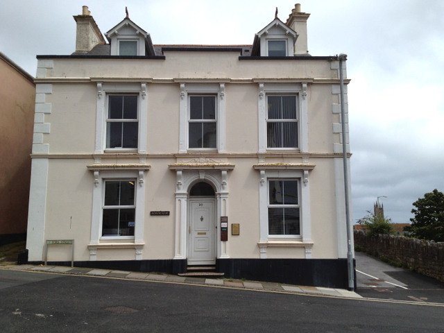
Image: © Robin Stott Taken: 16 Jul 2012
One of about three properties in the north end of Fore Street that was severed first by the railway and then by the A379. At the time of the photograph the property appeared occupied by three businesses. The attractive tiled steps to the front door are seen in Image
Images are licensed for reuse under creativecommons.org/licenses/by-sa/2.0
Image Location


Leaflet Map data © OpenStreetMap
Latitude
50.547659
Longitude
-3.497896