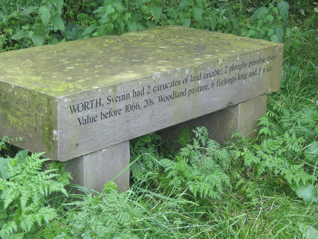
Sveinn Worth marker
Introduction
The photograph on this page of Sveinn Worth marker by Dave Pickersgill as part of the Geograph project.
The Geograph project started in 2005 with the aim of publishing, organising and preserving representative images for every square kilometre of Great Britain, Ireland and the Isle of Man.
There are currently over 7.5m images from over 14,400 individuals and you can help contribute to the project by visiting https://www.geograph.org.uk

Image: © Dave Pickersgill Taken: 19 Jul 2012
'Worth, Sveinn had 2 carucates of land taxable; 2 ploughs possible there Value before 1066, 20s. Woodland Pasture. 6 furlongs long and 3 wide.' This marker is on an off-cut from the Trans-Pennine Trail and reproduces text from the Domesday Book. The carucate was a unit of assessment for tax used in most Danelaw counties of England. The carucate was based on the area a plough team of eight oxen could till in a single annual season. It is nominally regarded as 120 acres (490,000 m2). Hence 2 carucates are about 0.375 square miles (240 acres). In addition, the woodland pasture is about 0.319 square miles (200 acres).

