Mansfield, Notts (Quaker Way)
Introduction
The photograph on this page of Mansfield, Notts (Quaker Way) by David Hallam-Jones as part of the Geograph project.
The Geograph project started in 2005 with the aim of publishing, organising and preserving representative images for every square kilometre of Great Britain, Ireland and the Isle of Man.

There are currently over 7.5m images from over 14,400 individuals and you can help contribute to the project by visiting https://www.geograph.org.uk
Mansfield, Notts (Quaker Way)
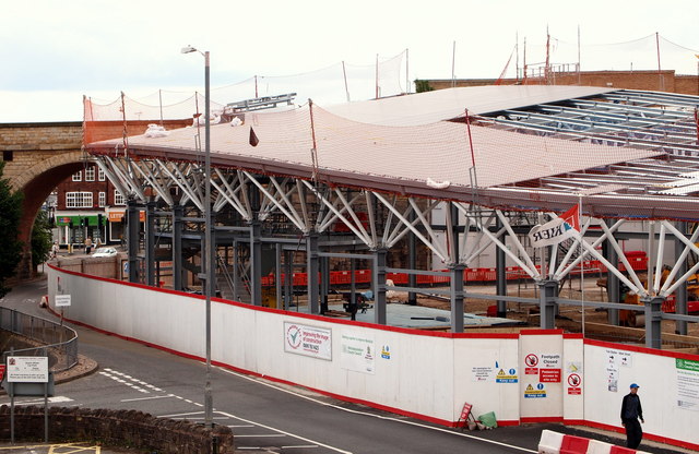
Image: © David Hallam-Jones Taken: 15 Jul 2012
The new £13m bus station on Quaker Lane is expected to open in Spring 2013 and will bring the railway station and the bus station much nearer to each other. This is the view looking in the direction of Albert Street, through the viaduct arch. It is said that on average 55 million users are expected to pass through this bus station each year, more than the number of passengers that use East Midlands Airport in any given year.
Images are licensed for reuse under creativecommons.org/licenses/by-sa/2.0
Image Location
Latitude
53.143086
Longitude
-1.198191