Coulsdon Town (formerly Smitham) station
Introduction
The photograph on this page of Coulsdon Town (formerly Smitham) station by Marathon as part of the Geograph project.
The Geograph project started in 2005 with the aim of publishing, organising and preserving representative images for every square kilometre of Great Britain, Ireland and the Isle of Man.

There are currently over 7.5m images from over 14,400 individuals and you can help contribute to the project by visiting https://www.geograph.org.uk
Coulsdon Town (formerly Smitham) station
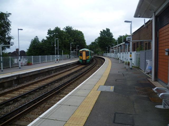
Image: © Marathon Taken: 18 Jul 2012
A branch line along the Chipstead valley from the Brighton Main Line was first projected in 1884. This scheme failed to take off. The line from Purley East Junction to Kingswood & Burgh Heath was eventually opened on 2nd November 1897 as a single track and this was doubled during 1899. The line finally reached Tattenham Corner on 4th June 1901 - Derby Day. Smitham station was opened on 1st January 1904, and briefly closed during the First World War. It lies on a sharp curve, where the line swings away westwards from the Brighton Main Line, and is immediately adjacent to the closed Coulsdon North station on the Main Line, whose passenger traffic was diverted here when the latter closed on 3rd October 1983. The Coulsdon relief road, opened in December 2006 as part of the A23, passes underneath the station and meant that some changes to the platform access routes was required. Consequently, no direct access to the London-bound platform now exists; access is only via the other platform and a new footbridge or a lift. A new station building on the down side of the line (seen here), and a standard-pattern accessible footbridge were opened in 2010. The Department for Transport requested that, following lobbying by Croydon Council, the train company look into a better name for the station, as Smitham was no longer used as the name of the local area, and the station was close to the centre of Coulsdon. The name chosen, after an exercise in local democracy, was Coulsdon Town. The change took place on Sunday 22nd May 2011.
Images are licensed for reuse under creativecommons.org/licenses/by-sa/2.0
Image Location
Latitude
51.322059
Longitude
-0.13333