Stevenson Square
Introduction
The photograph on this page of Stevenson Square by Gerald England as part of the Geograph project.
The Geograph project started in 2005 with the aim of publishing, organising and preserving representative images for every square kilometre of Great Britain, Ireland and the Isle of Man.

There are currently over 7.5m images from over 14,400 individuals and you can help contribute to the project by visiting https://www.geograph.org.uk
Stevenson Square
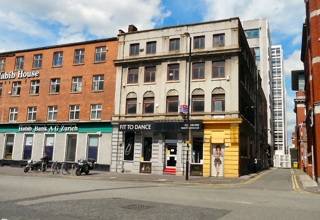
Image: © Gerald England Taken: 12 Jul 2012
Habib House on the NE side of Stevenson Square houses a branch of Habib Bank of Zurich. The building dates from the 19th Century and was originally Taylor's Winding Mill producing cotton and silk thread. http://manchesterhistory.net/manchester/tours/tour4/area4page61.html The ground floor of the premises next door were home to Fit to Dance http://www.f2dance.co.uk/ who supply all kinds of dancewear and accessories for dancing. They have a second shop in Altrincham. Their Manchester shop has since moved to Port Street. The three floors above them are currently empty, whilst the basement is home to the Hula Tika Lounge Image
Images are licensed for reuse under creativecommons.org/licenses/by-sa/2.0
Image Location
Latitude
53.482451
Longitude
-2.233379