Arnold, Notts
Introduction
The photograph on this page of Arnold, Notts by David Hallam-Jones as part of the Geograph project.
The Geograph project started in 2005 with the aim of publishing, organising and preserving representative images for every square kilometre of Great Britain, Ireland and the Isle of Man.

There are currently over 7.5m images from over 14,400 individuals and you can help contribute to the project by visiting https://www.geograph.org.uk
Arnold, Notts
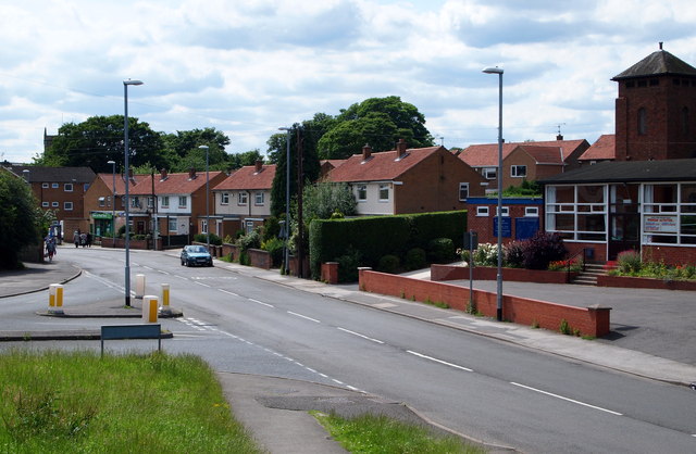
Image: © David Hallam-Jones Taken: 12 Jul 2012
A section of Calverton Road near to the point at which it becomes Church Street and continues in the direction of Arnold's town centre. Arnold United Reformed Church on the right is a church that began life as a Congregational Chapel in 1871 but changed its title in 1972 when three quarters of English Congregational churches merged with the English branch of the Presbyterian Church to form the United Reformed Church (URC). On the left is the junction with Surgey's Lane. The Surgey family has existed in Arnold since 1797. The surname seems likely to have arisen from the occupational name for a person who performed operations, mostly amputations, deriving from the Middle English and Old French term 'sur(ri)gien'. Before anaesthetics were invented only primitive surgery was possible and this was often carried out by a barber or attendant. Variant forms of the name include Surge(o)ner, Surgenor and Surgen and the first recorded use of it is thought to be that of William le Suriegien, in 1273, in the Hundred Rolls of Northamptonshire produced in the reign of King Edward 1.
Images are licensed for reuse under creativecommons.org/licenses/by-sa/2.0
Image Location
Latitude
53.010511
Longitude
-1.124041