
Calvary Church
Introduction
The photograph on this page of Calvary Church by Sue Adair as part of the Geograph project.
The Geograph project started in 2005 with the aim of publishing, organising and preserving representative images for every square kilometre of Great Britain, Ireland and the Isle of Man.

There are currently over 7.5m images from over 14,400 individuals and you can help contribute to the project by visiting https://www.geograph.org.uk
Calvary Church
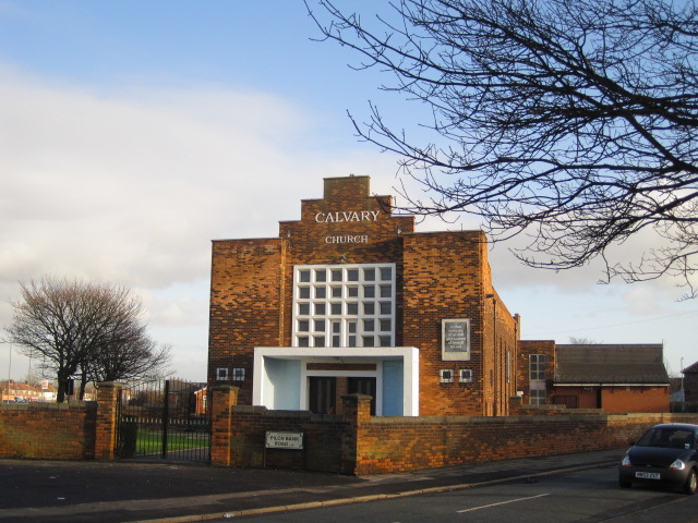
Image: © Sue Adair Taken: 17 Jan 2010
Built in 1938 this church was demolished July 2012, the building had been identified as having significant structural problems, made worse by several bad winters and a flood in the main hall which damaged almost all of the east side of the building. The cost of repairing the building was beyond the capability of the church. The congregation now use the smaller church hall to the rear of the site to which they hope to build a small extension.
Images are licensed for reuse under creativecommons.org/licenses/by-sa/2.0
Image Location

Latitude
53.418622
Longitude
-2.886952