Nantoer railway bridge, Abergavenny
Introduction
The photograph on this page of Nantoer railway bridge, Abergavenny by Jaggery as part of the Geograph project.
The Geograph project started in 2005 with the aim of publishing, organising and preserving representative images for every square kilometre of Great Britain, Ireland and the Isle of Man.

There are currently over 7.5m images from over 14,400 individuals and you can help contribute to the project by visiting https://www.geograph.org.uk
Nantoer railway bridge, Abergavenny
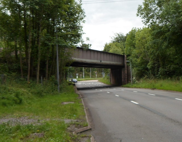
Image: © Jaggery Taken: 15 Jul 2012
This is one of two bridges carrying the Welsh Marches Line over the A40 about a kilometre south of Abergavenny railway station. This one carries the railway over the Abergavenny-bound carriageway of the A40. The other bridge is about 130 metres to the north, over the carriageway for vehicles leaving Abergavenny. The identification on the roadside wall of the bridge is Nantoer 23m 34c HNL. Kevin Flynn says that this indicates 23 miles and 34 chains from Rotherwas Junction on the Hereford and Newport Line. Rotherwas, a mile south of Hereford station, is no longer a junction. It was where the line to Ross-on-Wye (which closed in 1964) diverged from the main line.
Images are licensed for reuse under creativecommons.org/licenses/by-sa/2.0
Image Location
Latitude
51.807711
Longitude
-3.007996