Sidmouth floods (3)
Introduction
The photograph on this page of Sidmouth floods (3) by Anthony Vosper as part of the Geograph project.
The Geograph project started in 2005 with the aim of publishing, organising and preserving representative images for every square kilometre of Great Britain, Ireland and the Isle of Man.

There are currently over 7.5m images from over 14,400 individuals and you can help contribute to the project by visiting https://www.geograph.org.uk
Sidmouth floods (3)
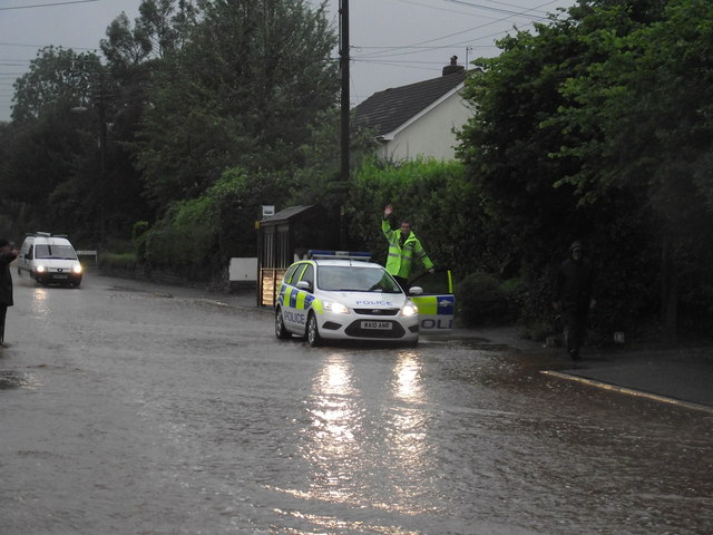
Image: © Anthony Vosper Taken: 7 Jul 2012
Woolbrook Road 7.30 in the morning, emergency services are at full stretch across East Devon as the county experiences its worst rain in 16 years. Despite this our friendly police officer managed a wave.
Images are licensed for reuse under creativecommons.org/licenses/by-sa/2.0
Image Location
Latitude
50.696307
Longitude
-3.247052