Old Hatch Farmhouse
Introduction
The photograph on this page of Old Hatch Farmhouse by Ian Capper as part of the Geograph project.
The Geograph project started in 2005 with the aim of publishing, organising and preserving representative images for every square kilometre of Great Britain, Ireland and the Isle of Man.

There are currently over 7.5m images from over 14,400 individuals and you can help contribute to the project by visiting https://www.geograph.org.uk
Old Hatch Farmhouse
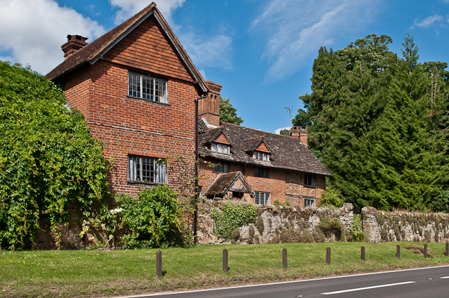
Image: © Ian Capper Taken: 30 Jun 2012
Dating originally from the 16th century with 17th,19th and 20th century additions. Grade II* listed - see www.historicengland.org.uk/listing/the-list/list-entry/1377801. For close up of the wall in front, see Image
Images are licensed for reuse under creativecommons.org/licenses/by-sa/2.0
Image Location
Latitude
51.217329
Longitude
-0.435121