Track from site of Northfield Cottage
Introduction
The photograph on this page of Track from site of Northfield Cottage by Lairich Rig as part of the Geograph project.
The Geograph project started in 2005 with the aim of publishing, organising and preserving representative images for every square kilometre of Great Britain, Ireland and the Isle of Man.

There are currently over 7.5m images from over 14,400 individuals and you can help contribute to the project by visiting https://www.geograph.org.uk
Track from site of Northfield Cottage
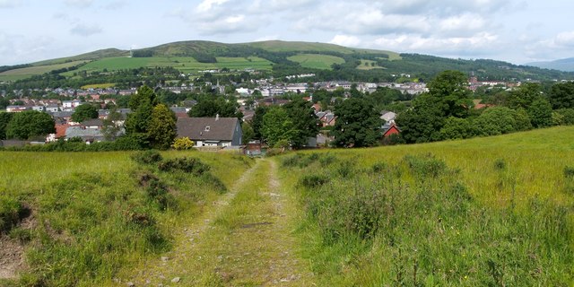
Image: © Lairich Rig Taken: 25 Jun 2012
This track would have provided access to Northfield Cottage when the latter was still standing (Image), but it is now simply a farm track. Downhill, at the edge of the field, are the backs of the houses on Hillbank Street (to the left) and its continuation, Northfield Road (to the right). They more or less correspond to the old Slunger Hill Road (in popular usage, simply "the Slunger"), on which, see Image Background details include Image on the skyline, left of centre, and the tower of Image on the right (best seen in larger image sizes). See also Image, a similar view but taken from further uphill (in the adjacent grid square to the east).
Images are licensed for reuse under creativecommons.org/licenses/by-sa/2.0
Image Location
Latitude
55.985196
Longitude
-4.567711