Benchmarks on St Helen's Church
Introduction
The photograph on this page of Benchmarks on St Helen's Church by Roger Templeman as part of the Geograph project.
The Geograph project started in 2005 with the aim of publishing, organising and preserving representative images for every square kilometre of Great Britain, Ireland and the Isle of Man.

There are currently over 7.5m images from over 14,400 individuals and you can help contribute to the project by visiting https://www.geograph.org.uk
Benchmarks on St Helen's Church
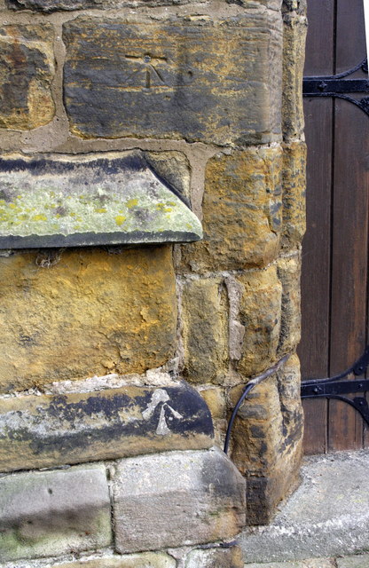
Image: © Roger Templeman Taken: 17 Jun 2012
There is an Ordnance Survey 1GL bolt benchmark on the top stone left of the door and an abandoned pivot benchmark below. These are described on the Bench Mark Database at http://www.bench-marks.org.uk/bm26650 and http://www.bench-marks.org.uk/bm43701 respectively
Images are licensed for reuse under creativecommons.org/licenses/by-sa/2.0
Image Location
Latitude
54.323299
Longitude
-1.487376