Stoke Bottom Lock
Introduction
The photograph on this page of Stoke Bottom Lock by Stephen McKay as part of the Geograph project.
The Geograph project started in 2005 with the aim of publishing, organising and preserving representative images for every square kilometre of Great Britain, Ireland and the Isle of Man.

There are currently over 7.5m images from over 14,400 individuals and you can help contribute to the project by visiting https://www.geograph.org.uk
Stoke Bottom Lock
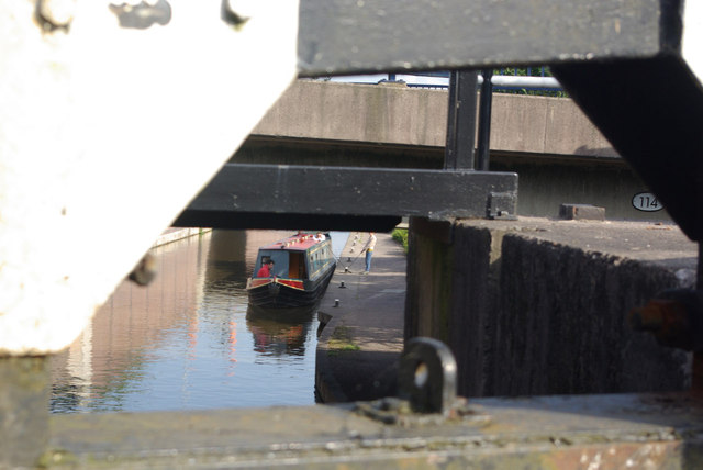
Image: © Stephen McKay Taken: 25 Jun 2012
A narrowboat waits to ascend glimpsed through the bottom gates of Stoke Bottom Lock by bridge 114.
Images are licensed for reuse under creativecommons.org/licenses/by-sa/2.0
Image Location
Latitude
53.009725
Longitude
-2.185361