The Bull
Introduction
The photograph on this page of The Bull by Roger Jones as part of the Geograph project.
The Geograph project started in 2005 with the aim of publishing, organising and preserving representative images for every square kilometre of Great Britain, Ireland and the Isle of Man.

There are currently over 7.5m images from over 14,400 individuals and you can help contribute to the project by visiting https://www.geograph.org.uk
The Bull
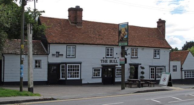
Image: © Roger Jones Taken: 1 Jul 2012
There have been a few changes since this was last photographed: the sign has changed, and the old wheel has gone. There are many local placenames with "Bull" in the title: "Great Bull Wood" and "Bullwood Hall" as well as "Bullwood Road". Given the pub dates from the c16 it seems likely that the wood got its name from the pub. It is a listed building, List entry Number: 1147795 http://list.english-heritage.org.uk/resultsingle.aspx?uid=1147795 It is it is said (on some of the publicity) that Dick Turpin was hung from one of the beams of the pub.
Images are licensed for reuse under creativecommons.org/licenses/by-sa/2.0
Image Location
Latitude
51.600758
Longitude
0.64545